


9NEWS has issued a Weather Impact Day for tonight and Sunday morning to help you make any outdoor or travel plans.
DENVER — Happy Saturday! It’s the last day of summer 2024 and Mother Nature has a big change in store as we get ready to welcome fall at 6:43 a.m. on Sunday. Our weekend will be much cooler and it will feature the development of widespread rain and snow by tonight.

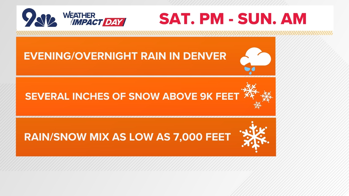
If you need to make outdoor plans, most of your Saturday will be ok. You’ll notice the cooler temperatures and it will be windy at times. Clouds will also be on the increase from the southwest. By this afternoon, we’ll see rain and snow developing in western and southern Colorado. That moisture will spread into central and eastern parts of the state by this evening.
The 9NEWS Weather Impact Team has issued a Weather Impact Day for tonight and tomorrow morning to create an awareness of this weather change. This storm will have the most impact on those planning to travel overnight, especially through the north-central mountains. Any evening or overnight plans in Denver will also be wet.

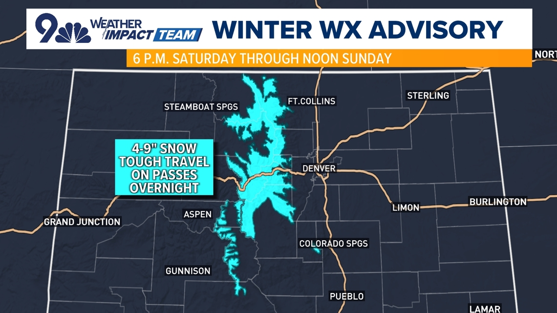
The National Weather Service has issued a Winter Weather Advisory from 6 p.m. this evening through noon on Sunday for Colorado’s north-central mountains. Some locations in the advisory area could see as much as 4 to 9 inches of snow. Overnight travel problems could develop at pass level, especially on routes such as I-70, U.S. 40 and U.S. 285 outside of Denver.
The foothills could be cold enough for a little rain-snow mix before sunrise on Sunday. If there is any accumulation it will be on the light side and mainly confined to grassy or elevated surfaces.
As with most storms we will see a wide variety of rain totals around the region. Realistically we are looking at totals averaging between a 0.10″ and 0.30″ but some areas could get a half inch or more before it all ends tomorrow morning.

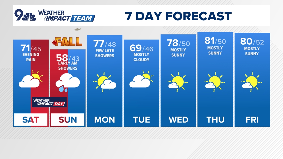
Sunday will be the coolest day of the upcoming week with highs for many locations running several degrees below normal. The day will start off cloudy around the region but we should see some clearing through the afternoon.
Sunshine and much warmer weather will return starting on Monday. A fast-moving weather system could bring a little more rain and snow late Monday into Tuesday but the confidence is low. We’ll have a better idea of that once the current storm passes by.
Denver forecast
SATURDAY: Sunny early, then turning cloudy with rain likely after 6 p.m., high 71. Cloudy overnight with showers continuing, low 45.
SUNDAY: Cloudy with lingering showers before 10 a.m., then a gradual clearing into the later afternoon and evening. High 58, low 43.
MONDAY: Sunny and mild with a few late-day showers, high 77. Mostly cloudy overnight, low 48.
TUESDAY: Mostly cloudy with an early chance for showers, high 69. Partly cloudy overnight, low 46.
WEDNESDAY: Mostly sunny and mild, high 78. Partly cloudy overnight, low 50.
THURSDAY: Mostly sunny and mild, high 81. Partly cloudy overnight, low 50.
FRIDAY: Mostly sunny and mild, high 80. Partly cloudy overnight, low 52.


More Stories
Widespread storm brings chances for rain, snow to Colorado
Harris challenges Trump to second US presidential debate
UN chief ‘gravely alarmed’ by reports of RSF assault on Sudan’s el-Fasher