A cold front in Colorado will push in the potential for Denver’s first snow and hard freeze, and feet of snow in the mountains.
DENVER — The 9NEWS Weather Impact Team has declared a Weather Impact Day on Wednesday as a cold front arrives in Colorado.
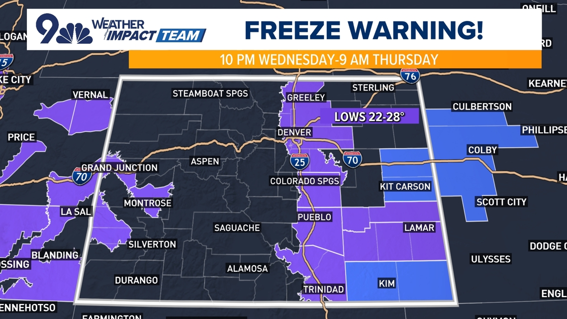
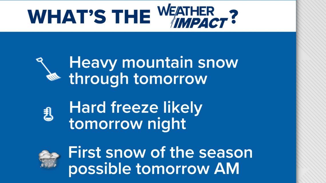
Winter weather alerts have been posted in Colorado’s high country for up a foot of snow while Denver and the eastern Colorado plains have a Freeze Warning in effect late Wednesday for the first hard freeze.
Denver hard freeze, rain, snow
The cold front arrived in Denver Tuesday afternoon, increasing winds and bringing in clouds.
The high temperature in Denver will drop more than 40 degrees from Monday to Wednesday with this cold front. Denver’s high temperature is forecast to be 41 degrees today after a record-tying high of 82 on Monday.
The Front Range, including the Denver metro area, will see its first hard freeze tonight. The forecast low temperature in Denver is 26 degrees tonight, with some lower 20s likely on the Eastern Plains and single digits in the high country.
A Freeze Warning covers the Denver urban corridor starting 10 p.m. Wednesday to 9 a.m. Thursday morning. Frost and freeze conditions are expected kill unprotected sensitive vegetation and possibly damage unprotected outdoor plumbing.
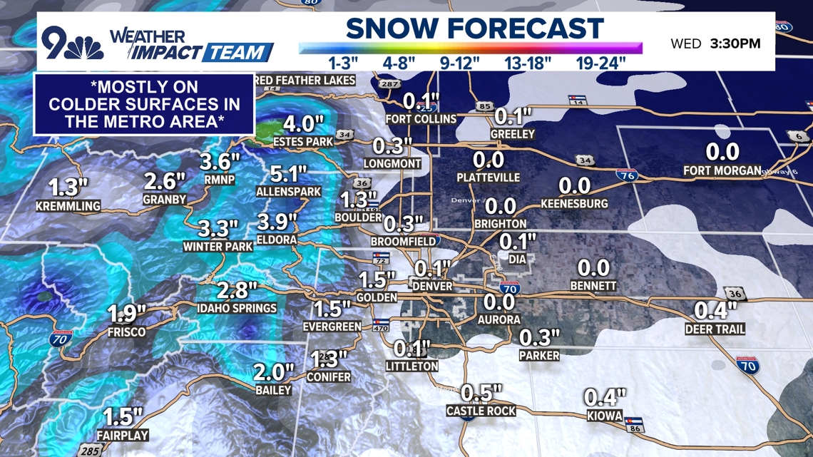
In the Denver area, a light rain/snow mix along with areas of fog or freezing drizzle will be likely for the Wednesday morning commute in the Denver area, but snow totals look unimpressive in the metro area, with perhaps a slushy inch or two of snow on colder surfaces in the southern and western Front Range foothills.
It will be the first snow of the season in the metro area. Denver only officially need 0.1″ at Denver International Airport for it to officially count as the first snow of the season.


Colorado mountain snow
Mountain snow began falling Tuesday in the San Juan Mountains and across southern and western Colorado.
The National Weather Service in Boulder issued a Winter Weather Advisory until noon Wednesday for the San Juan Mountains, Elkhead Mountains, Grand Mesa, Battlement Mesa and Park Mountains. Snow accumulations in the mountains could be up to 11 inches with locally higher amounts in some areas.
Colorado’s southern and western mountains may get locally more than a foot of snow, most of that Tuesday morning and into early Tuesday afternoon. Colorado’s central and southern mountains are favored for the higher totals of 10 to 13 inches.
Roads, and especially bridges and overpasses, will likely become slick and hazardous. The National Weather Service said travel could be very difficult to impossible. The hazardous conditions could impact commutes on Tuesday morning and evening and into Wednesday morning.

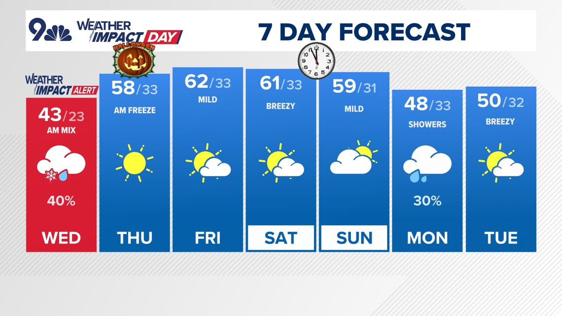
We’ll dry out and warm up after today, with highs in the 50s and 60s in Denver before our next storm system and cooler temperatures for Monday and Tuesday of next week.
Denver forecast
- WEDNESDAY: Mostly cloudy, chilly, morning rain and snow showers, high 43. Partly cloudy overnight, low 23.
- THURSDAY: Partly cloudy and seasonal, high 58. Partly cloudy overnight, low 33.
- FRIDAY: Mostly sunny and cool, high 62. Mostly clear and chilly overnight, low 33.
- SATURDAY: Partly cloudy, breezy and mild, high 61. Quiet overnight, low 33.
- SUNDAY: Partly cloudy, breezy and mild, high 59. Quiet overnight, low 31.
- MONDAY: Turning mostly cloudy with a chance for late-day showers, high 48. Mostly cloudy overnight, low 33.
- TUESDAY: Partly cloudy and mild, high 50. Mostly cloudy overnight, low 33.






More Stories
Evacuations lifted for Highland Lakes Fire
Doorbell camera video helped police identify and locate kidnapping suspect
Hezbollah says will only accept ‘suitable’ truce as Israel pounds Baalbek