


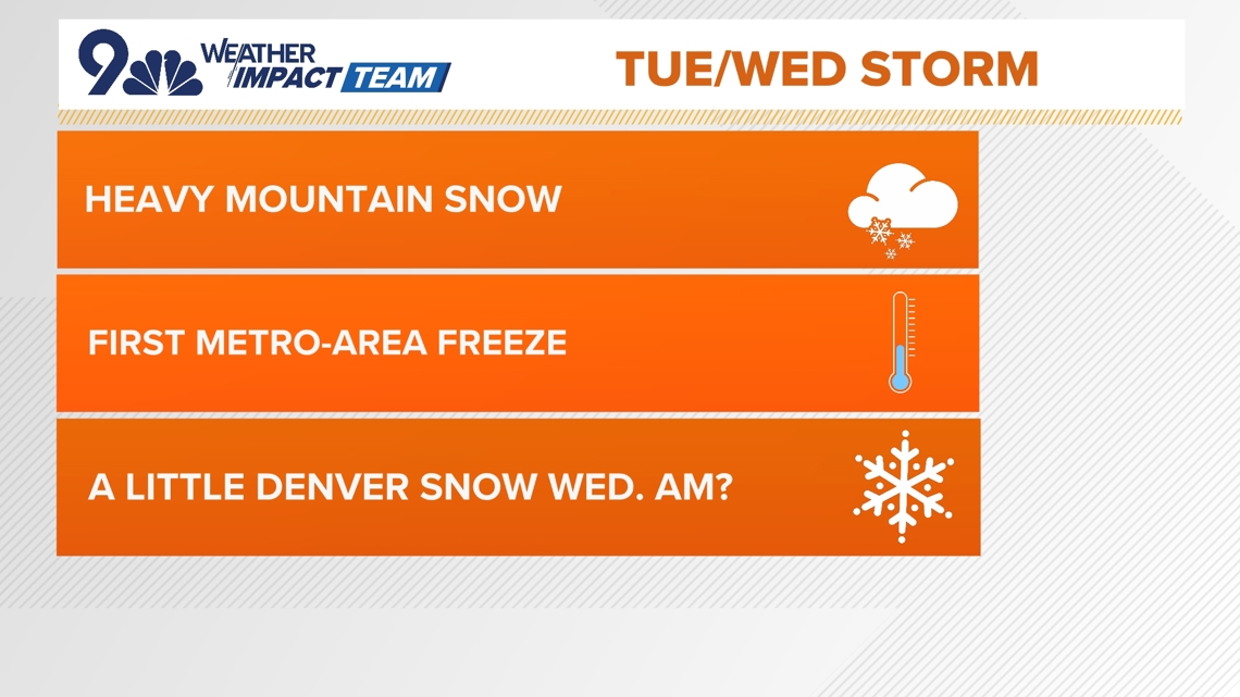
A sharp cold front arrives late on Tuesday, which’ll push in the potential for Denver’s first snow of the season on Wednesday morning.
DENVER — FORECAST BY: 9NEWS Weather Impact Team Meteorologist Chris Bianchi
THE FORECAST AT A GLANCE:
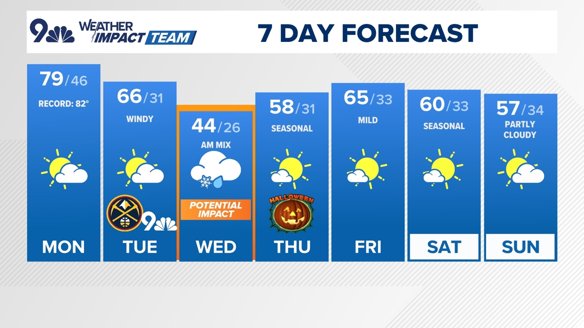
We’ve got one more very warm and potentially breezy day ahead before big changes arrive for Tuesday.
We’ll be near a daily record with a high of 79° in Denver and some high clouds once again for today, with a Red Flag Warning and High Wind Watch for southeastern parts of the state. Wind will be more of an issue south of the Palmer Divide, where gusts could reach 60 mph in spots. In Denver, winds will be more in the 10-20 mph range in town.
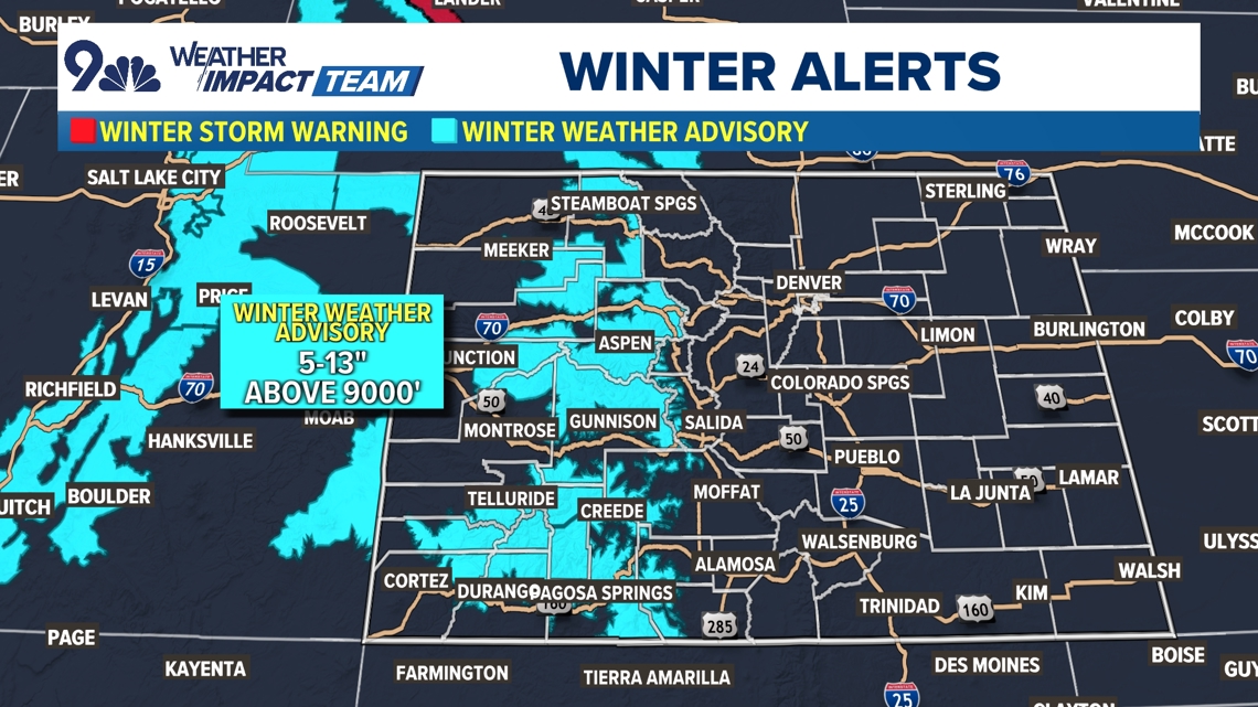
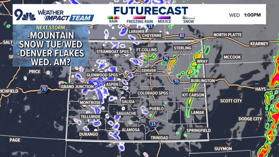
Our big change starts to arrive tonight with rain and mountain snow developing in the high country, especially in the San Juans and across southern and western Colorado. That snow will be heavy at times on Tuesday, and Winter Weather Advisories cover most of the high country where as much as 10-13″ of snow could fall. Our central and southern mountains are most favored for those higher totals. Be careful if you’re planning on driving through the mountains on Tuesday or Wednesday – it’ll be slick at or above pass level!
Meanwhile in Denver, a sharp cold front arrives sometime on Tuesday afternoon. That’ll pick up our wind and bring us some clouds, and eventually we’ll see a bit of a light slushy mix arrive for Wednesday morning. Snow totals look unimpressive in the metro area, with perhaps a slushy inch or two of snow on colder surfaces in our southern and western foothills.
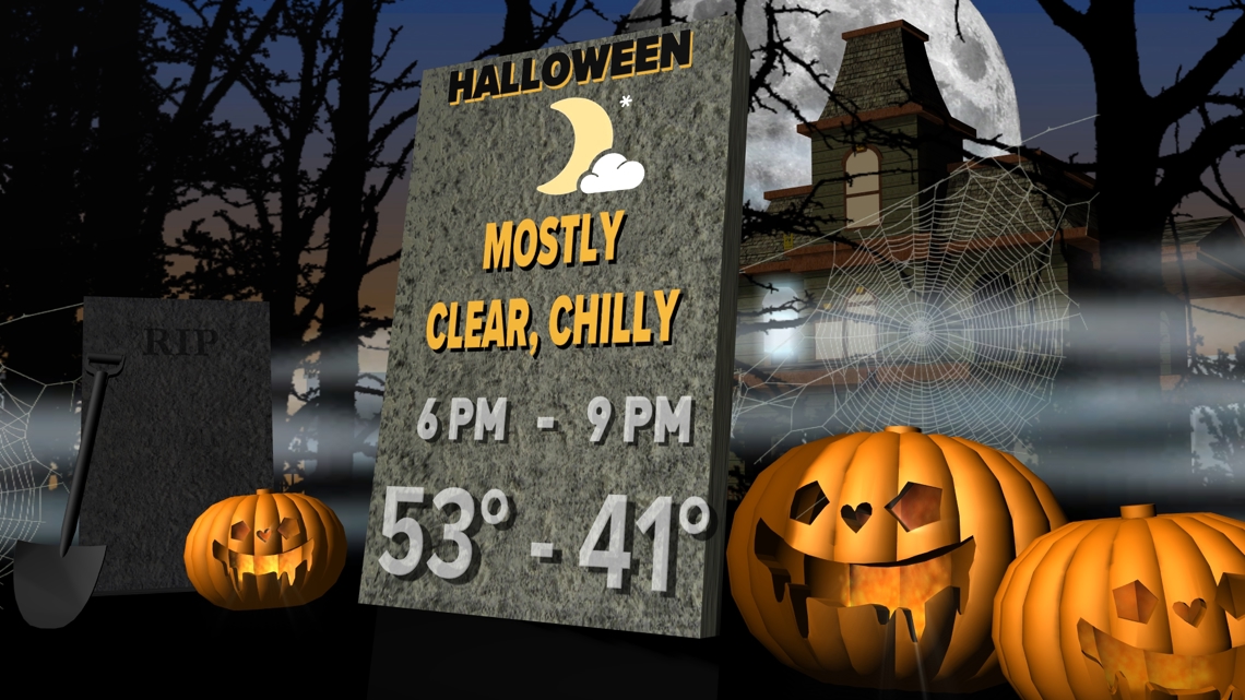
We’ll clear out for Halloween, with a high in the upper 50s (almost exactly seasonal for late October). We’ll stay dry through the upcoming weekend with highs in the upper 50s or lower 60s into early next week.
Keep an eye on the next storm and we’ll keep you posted with the very latest on it!


MONDAY: High clouds and breezy at times with elevated fire danger, high 79. Mostly cloudy overnight, low 46.
TUESDAY: Partly cloudy, windy and turning much cooler, high 66. Mostly cloudy with rain/snow showers possible overnight, low 31.
WEDNESDAY: Mostly cloudy and chilly with morning rain and snow showers, high 44. Partly cloudy overnight, low 26.
THURSDAY (HALLOWEEN): Partly cloudy and seasonal, high 58. Partly cloudy overnight, low 31.
FRIDAY: Mostly sunny and cool, high 65. Mostly clear and chilly overnight, low 33.
SATURDAY: Partly cloudy, breezy and mild, high 60. Quiet overnight, low 33.
SUNDAY: Partly cloudy, breezy and mild, high 59. Quiet overnight, low 34.
MONDAY: Mostly sunny and seasonably warm, high 57. A few clouds overnight, low 32.


CLOSINGS: Latest closings and delays in Colorado
WEATHER LINE 9: Updated weather forecast information at 303-871-1492.
TRAFFIC CENTER: Keep up on crashes and travel times here
If you have a weather report, photo or video to share, you can contact the 9NEWS Weather Team in these ways:
EMAIL: Weather photos, videos
Share updates on our Facebook wall: facebook.com/9weather
Tweet your updates using the hashtag #9WX or tweet us at twitter.com/9NEWSWeather
Download the 9NEWS app:
iTunes: on9news.tv/itunes
Google Play: on9news.tv/1lWnC5n
9NEWS Weather Impact Team
The 9NEWS Weather Impact Team of Kathy Sabine, Cory Reppenhagen, Laurann Robinson, Keely Chalmers and Chris Bianchi update the Denver weather forecast multiple times each day.
Bookmark this link to always have the latest forecast from 9NEWS. The team values your local weather reports and often features your photos and videos during weather segments in all newscasts.


More Stories
Daylight saving time ending: How to prepare for the potential health effects
Bad Bunny backs Harris after comedian’s racist jokes at Trump event
Erik ten Hag sacked as Manchester United manager