


We’re in the 60s today under mainly sunny skies, but we’ll get a taste of all four seasons over the next few days.
DENVER — FORECAST BY: 9NEWS Weather Impact Team Meteorologists Chris Bianchi
THE FORECAST AT A GLANCE:
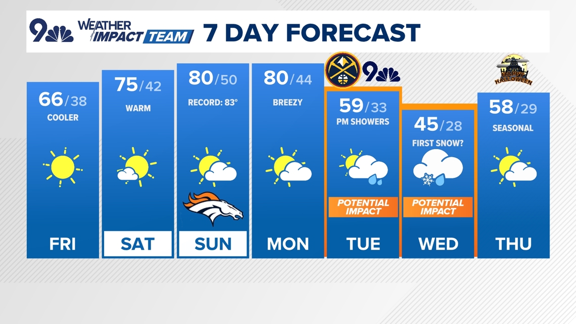
After our coolest morning in almost six months, we’ll rebound temperatures nicely today under southerly winds. Highs will reach the mid-60s under mainly sunny skies, after a low of about 33° officially at Denver International Airport (the low was warmer downtown and for most of the metro area, though).
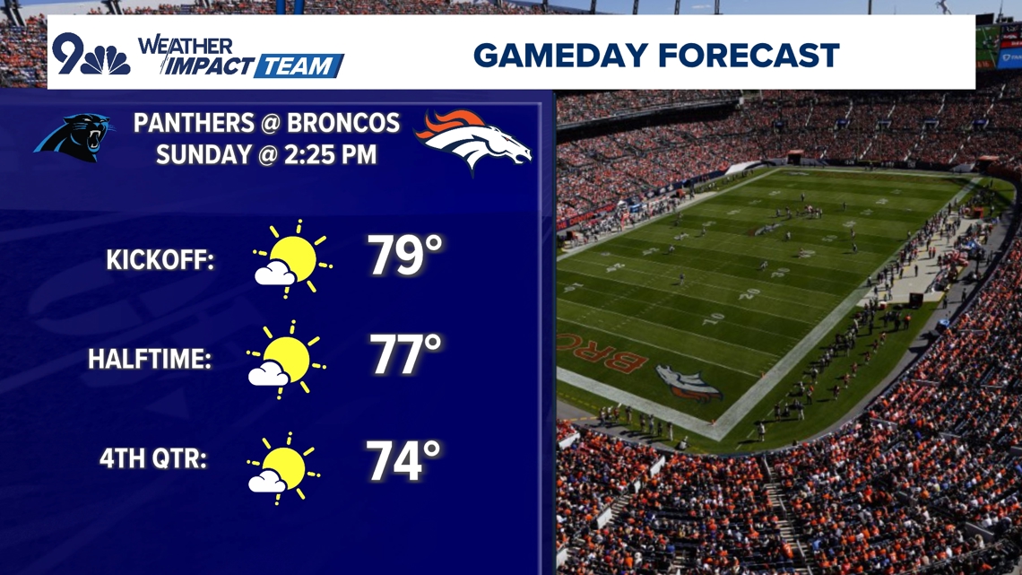
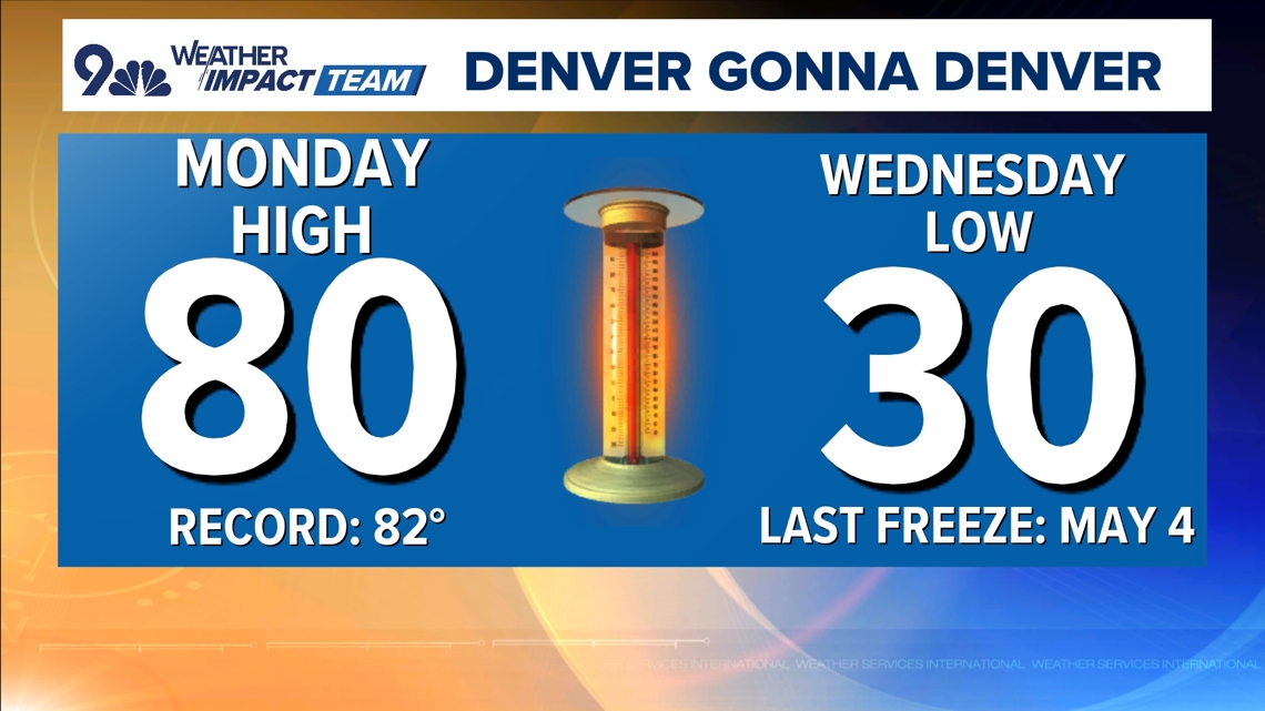
It’ll stay warm through the upcoming weekend, with highs spiking into the mid-70s on Saturday and we’ll be near 80° on both Sunday and Monday, with near-record heat possible for the latter two days.
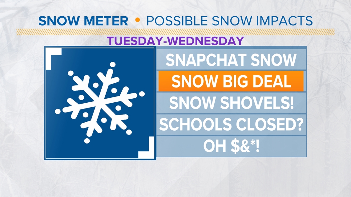
We’ll have to watch for some wind and high fire danger on Monday ahead of our next storm system that arrives on Tuesday. That storm will bring us our first widespread freeze (32° or lower temperature) across the I-25 urban corridor, and it’ll bring us some rain showers initially on Tuesday night before potentially flipping over to snow for Wednesday morning.
If you’re a snow-lover, don’t get too excited (yet) in the Denver area: This doesn’t look like much, but it could be enough to get us on the board for the first time this season. The mountains could get several inches of snow on Tuesday and Wednesday, though.
Otherwise, chilly temperatures will be the big story next week, with highs mostly in the 40s and 50s. We may have another rain or snow chance later in the week, though computer models are in disagreement about that part of the forecast.
In the meantime, enjoy the warmer weather if that’s your thing, and if not, you’ll get the big cooldown next week!

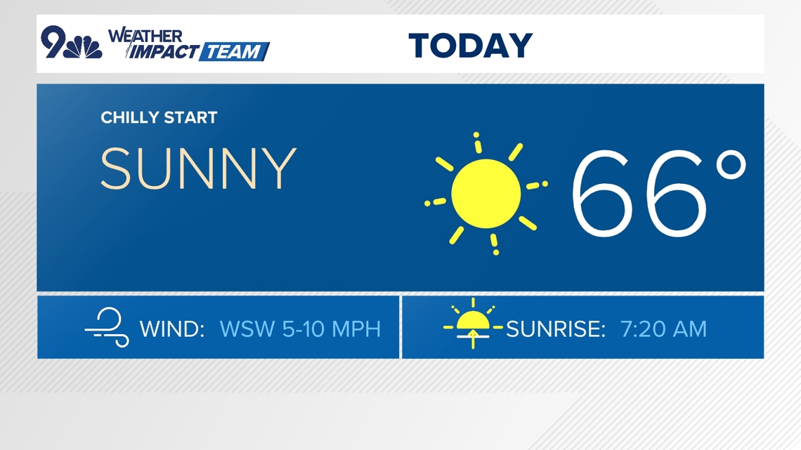


FRIDAY: Mostly sunny and a bit cooler, high 66. Mostly clear overnight, low 38.
SATURDAY: Mostly sunny and warm, high 75. Partly cloudy overnight, low 42.
SUNDAY: Mostly sunny and warm, high 80. Mostly cloudy overnight, low 50.
MONDAY: Partly cloudy and warm, high 80. Partly cloudy overnight, low 44.
TUESDAY: Partly cloudy and much cooler with afternoon rain showers, high 59. Mostly cloudy, with rain/snow showers overnight, low 33.
WEDNESDAY: Mostly cloudy and chilly with morning snow showers, high 45. Partly cloudy overnight, low 28.
THURSDAY (HALLOWEEN): Partly cloudy and seasonal, high 58. Partly cloudy overnight, low 29.
FRIDAY: A few clouds and cool, high 55. Mostly clear and chilly overnight, low 31.

CLOSINGS: Latest closings and delays in Colorado
WEATHER LINE 9: Updated weather forecast information at 303-871-1492.
TRAFFIC CENTER: Keep up on crashes and travel times here
If you have a weather report, photo or video to share, you can contact the 9NEWS Weather Team in these ways:
EMAIL: Weather photos, videos
Share updates on our Facebook wall: facebook.com/9weather
Tweet your updates using the hashtag #9WX or tweet us at twitter.com/9NEWSWeather
Download the 9NEWS app:
iTunes: on9news.tv/itunes
Google Play: on9news.tv/1lWnC5n
9NEWS Weather Impact Team
The 9NEWS Weather Impact Team of Kathy Sabine, Cory Reppenhagen, Laurann Robinson, Keely Chalmers and Chris Bianchi update the Denver weather forecast multiple times each day.
Bookmark this link to always have the latest forecast from 9NEWS. The team values your local weather reports and often features your photos and videos during weather segments in all newscasts.


More Stories
Why some houses might have different colored pumpkins on display this Halloween and what it means
Tyler, The Creator books Denver arena concert
Israelis break into north Gaza as military’s deadly siege continues