


Six out of the last seven La Niña winters have resulted in below average snow in Denver, but mountain snowpack has been variable.
DENVER — Last winter was controlled by an El Niño weather pattern that tends to bring more snow to the Colorado mountains, and the season finished with above average snowpack.
But the opposite pattern, called a La Niña, will likely develop this season. That doesn’t mean less snow; however, it means more variability. A La Niña pattern is expected to develop in October or November according to the latest forecast from NOAA climatologists.
A typical La Niña weather pattern brings colder conditions to some of the northern states and warm dry conditions to the southern states.

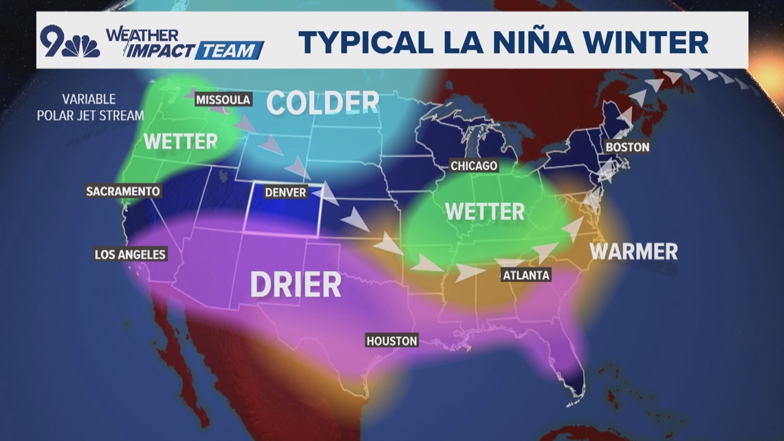
In Colorado, below average snow is slightly favored in the southern San Juan Mountains, which can sometimes lower the statewide average, but most of the state does not typically see any consistent La Niña impacts.
The type of La Niña also matters. This La Niña will be arriving late. They usually develop before the end of summer. It is also forecast to be weak to moderate in strength.
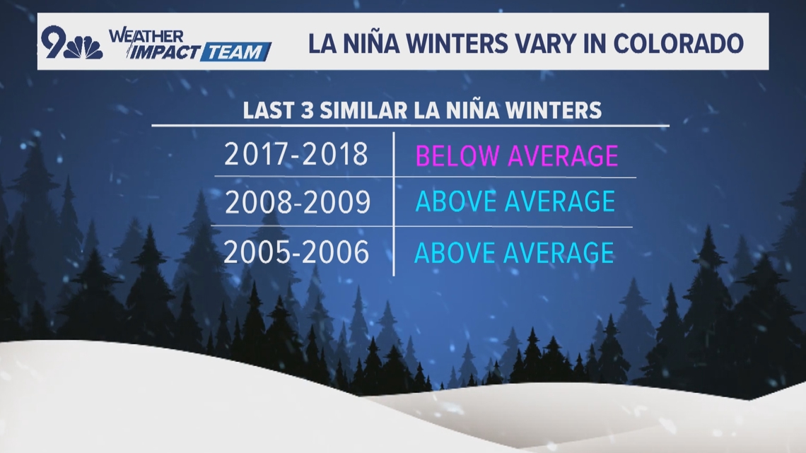
The last three similar La Niña patterns brought mixed results to Colorado, with two snowy winters and one of the state’s least snowy winters in the 2017-2018 season.
But those are the only three examples of late-arriving, weak-to-moderate La Nina patterns over the past 30 years.

For Denver, a La Niña tends to be less snowy more consistently, with six out of the last seven La Niña patterns resulting in below average snow.
Based on that limited trend, there’s a good chance Denver ends up with less than 56 inches of snow this winter, which is the average amount the city receives in a season.


More Stories
Miracles happen! Anne Hathaway confirms return for ‘Princess Diaries 3’
Water levels in major Amazon tributary tumble to record lows amid drought
Good News birthday celebration